

The Moroccan Hercynides
By Christian Hoepffner, Abderahmane Soulaimani, Alain Pique
Department of Geology, Faculty of Sciences, University Mohammed V, B.P. 1014 Rabat, Morocco
Department of Geology, Faculty of Sciences, University Cadi Ayad, B.P. S 20, Marrakech, Morocco
21 Rd Point de l’Esplanade, 67 000, Strasbourg, France
Received 5 April 2004; accepted 18 July 2005
Available online 18 November 2005
Abstract
In Northern Africa deformed Paleozic rocks are observed, mainly in Morocco where they are present in two structural domains: (i) the southern domain, i.e. the Anti-Atlas belt. In this northern rim of the West African craton, the Paleozoic sequences are mildly deformed; (ii) the northern Mesetan domain, itself subdivided into several structural subzones, corresponds—with its eastern prolongation in Algeria- to the Hercynian/Variscan belt of Northern Africa.
In the Meseta, the study of the sedimentological history and the structural analysis of the various subzones allow to discuss the tectonic characters of the Hercynian/Variscan orogeny in Northern Africa:
– The deformation was realized through three main events: (i) the Late Devonian, Eovariscan Phase, which developed in the eastern zones of the Moroccan Meseta, northwestern Algeria and in the presently Alpine allochthonous domains of the Rif and Kabylias;
(ii) The Visean Phase, which was restricted at the limit between the Moroccan eastern and western Meseta. The two preceding compressional events were contemporaneous with the development of Late Devonian-Early Carboniferous transtensive sedimentary basins; (iii) the Late Carboniferous Phase, during which the regional shortening affected the entire Hercynian domain, including the Moroccan western Meseta and Anti-Atlas.
– The Anti-Atlas differs fundamentally from the Mesetan domains by: (i) its relatively mild deformation; (ii) the vergence of its regional structures, directed toward the West African shield, whereas the main vergence is toward the west in the Meseta domains.
– In the Anti-Atlas like in the weakly deformed zones of the Meseta, the deformation is heterogeneous, being concentrated along several regional shear zones. Sedimentological and stratigraphic evidences point out the control exerted by these long-lived weakness zones through the sedimentation, and the deformation.
– No direct evidence can be found to invoke the development of a Paleozoic oceanic lithosphere in the considered domains. Therefore, the Hercynides/Variscides of North Africa are considered to be outside the inner zones of the European belt, at the northern border of the Paleo-Gondwana, and probably related to the Appalachian belt of North America.
2005 Published by Elsevier Ltd.
1. Introduction
More than one century ago, some workers penetrated, with strong difficulties, the Moroccan territory and they began to decipher its then ignored geology. Among them Thomson crossed the High Atlas Mountains in 1888. He described eruptive rocks (the Atlasic Palaeozoic massif) as an island inside the Cretaceous sea, and the red lacustrine
Nfis sandstones, which are folded (Thomson, 1889).
From this onwards, the reality of the Hercynian and the subsequent Atlasic deformations was ascertained.
During the beginning of the 20th century, Gentil performed an extensive field work north of the High Atlas Mountains. ‘‘The structure of the plateaus is characterized by a folded Palaeozoic basement, unconformably covered by transgressive Mesozoic deposits, which remained mostly horizontal. Due to the erosion, we see that a wide chain, developed by the end of Carboniferous times (i.e. the Hercynian chain) has been completely eroded. This structure of western Morocco has to be compared to the Iberian Meseta’’ (Gentil, 1918; translated). Following Gentil, Lecointre (1926) carefully mapped northwestern Morocco while other geologists, most of them belonging to the newly constituted Geological Survey of Morocco, spread the knowledge of the country in Northern Morocco and south of the High Atlas as well. A complete list of the references is given by Morin (1964, 1970, and 1979).
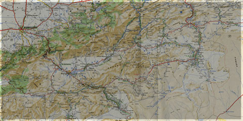
As shown by the ancient authors, the Hercynian (=Variscan) chain of Northern Africa, extending from western Mauritania to Northern Algeria, is best exposed in Morocco where the extended outcrops of Palaeozoic rocks allow to distinguish several structural domains (Fig. 1).
– The Saharian domain: in southern Morocco the Anti-Atlas domain presents Precambrian inliers cartographically surrounded by more or less deformed Palaeozoic rocks. Hercynian folds are known also in the Algerian Ougarta and in western Mauritania. In the extreme south, the Tindouf basin is the undeformed Palaeozoic cover of the West African craton (Reguibat Rise).
– Middle Morocco, where the existence of the Hercynian deformation has been first recognised (Gentil, Lecointre, etc.), is subdivided into two zones: (i) the Meseta, where several massifs made of deformed Palaeozoic rocks are inliers, cartographically separated by a thin and tabular Mesozoic and Cenozoic cover; (ii) the High and Middle Atlas where the Palaeozoic massifs, similar to those of the Meseta, are separated by a thick and folded sedimentary cover. The Atlasic shortening remained weak and correlations between the Palaeozoic massifs of the Meseta and of the Atlas are possible.
– The Rif, a part of the Alpine chain of western Mediterranean: the shortening was important and renders difficult, although not impossible, comparisons between the Rifean Palaeozoic series and the other Palaeozoic massifs of Morocco. The Algerian Alpine Tell belt bears
Palaeozoic blocks, for instance the Kabylias, which are very similar to those of the Moroccan Rif.
The existence of the Hercynian deformation throughout Morocco and adjacent Algeria lead to distinguish several structural zones (Michard, 1976; Pique´ and Michard, 1981, 1989; Michard et al., 1989; Pique´, 1984, 1989, 1994, 2001), which are described below. The definition of the structural zones will in turn allow to present the main characteristics of the Hercynian orogeny in Northern Africa and to tentatively replace the Hercynian belt of North
Africa within the tectonic frame of the Hercynian orogeny of Western Europe.

Fig. 1. Structural subdivisions of North Africa and location of the Paleozoic terranes. 1: Rifian-Tellian belt, a: southern front of the chain; b: Paleozoic allochtonous terranes of the internal zones. 2: Atlasic belt (HA: High Atlas, SA: Saharian Atlas, TA: Tunisian Atlas, MA: Middle Atlas). 3: Paleozoic, a:deformed by variscan orogeny, b: undeformed. 4: West African craton (Archean and Proterozoic massifs). 5: Mauritanides allochtones.
2. The palaeozoic evolution of the Hercynian structural domains
2.1. The Saharian domain
2.1.1. The palaeozoic sedimentation (Table 1)
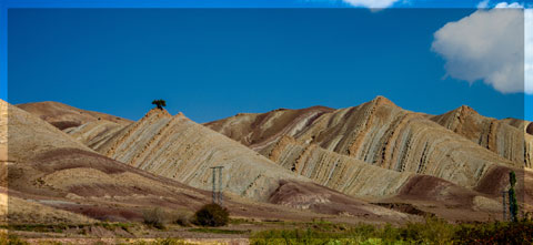
Between the northern limit of the West African craton and the Hercynian orogenic domains of central Morocco (see below), the Anti-Atlas (Choubert, 1947, 1963) is a large and open antiform, bent during the Atlasic orogeny.
Its structural grain trends WSW–ENE in its western part, from which it prolongates toward the Zemmour belt, E–W in its central part, and ENE–WSW in the east, where it connects to the Algerian Ougarta (Figs. 1 and 2). It is separated from the High Atlas by the recent Ouarzazate and Souss troughs. Its main characteristics are the wide outcrops of Precambrian rocks, visible in several inliers (‘‘boutonnie`res’’), which are covered by Palaeozoic rocks.
The Precambrian times in Anti-Atlas have been marked by the development of the Eburnian orogeny, at about 2000 Ma and the Pan-African orogeny, at about 700–600 Ma. The oldest granitoids and metamorphic episodes are related to the Eburnian orogeny (Charlot, 1978; Aı¨t
Malek et al. 1998; Thomas et al. 2002; Walsh et al, 2002). The most obvious traces of the Pan-African orogeny are seen in the central Anti-Atlas, where an ophiolitic sequence has been described (Leblanc, 1972, 1975; Saquaque et al., 1989). This ‘‘Pan-African suture’’ is traced southeasterly in Algeria, as far as the Hoggar (Black and Lie´geois, 1993) although its actual signification is currently discussed (Ennih and Lie´geois, 2001).
After the deposition of the latest Proterozoic volcanic series and redbeds (Ouarzazate series, 575–560 Ma; Thomas et al., 2002), at least partly related to crustal extension (Pique´ et al., 1999; Soulaimani et al., 2003), an eastward-directed transgression started at the very beginning of the Cambrian. This event can be observed all over the Anti-Atlas domain. The first sediments were detrital, but open marine conditions rapidly developed, inducing during the Lower Cambrian, at least in the western and central Anti-Atlas, and the development of a shallow platform, more subsident in the western Anti-Atlas (Choubert, 1963; Benziane et al., 1983). During this period, the so-called Lower and Upper Limestones were deposited, separated by purple shales (Lie-de-vin series) representing a brief regressive episode. After a regression (and an emersion?) at the end of the Cambrian, the sea invaded again the domain for a long time at the beginning of the Ordovician.
The region was still a shallow and epicontinental platform.
The Ordovician sediments were typically detrital, being composed of sands and clays, all issued from the Saharian continent (Destombes et al., 1985). At the end of the Ordovician a regional glaciation developed (Ouanaimi, 1998), the Anti-Atlas being located not far from the ice cap that spread over western Africa (Deynoux, 1978). The end of the glaciation occurred at the beginning of the Silurian and it was the cause of a glaciogenic transgression over Morocco. Black shales were deposited in confined marine environments and poorly oxygenated waters. At that time the African shield, eroded since a long time and covered by the marine transgression, did not provide more than very fine argillaceous minerals. Furthermore, during the Lower Devonian, even those fine detrital sediments lack in the Anti-Atlas marine basin, and limestones, often reefal, were deposited onto the carbonate platform.
During the extensional regime that had characterised the first part of the Palaeozoic, the clastics were issued from the West African craton. From the Devonian, the extensional regime changed to a compressive one, expressing the development of the Hercynian orogeny. The Proterozoic axis of the Anti-Atlas rose up and became the source of the clastics (Wendt, 1985; Hassenforder, 1987). As a consequence, the Late Devonian and Carboniferous sequences deposited in the Anti-Atlas are typically detrital: sandstones, clastic limestones and argillites.
Table 1
Simplified paleozoı¨c evolution of the main structural zones of the Northern (Mesetian) domain

1: panafrican basement (Anti-Atlas); 2: sandstones and quartzites; 3: shales and greywackes; 4: shales and psammites; 5: basin deposits (deltaic or deep sea fan sequences); 6: continental redbeds (conglomerates, sandsones); 7: limestones; 8: black shales; 9: volcanoclatic deposits with calk-alkaline volcanism; 10: alkaline to tholeitic volcanism; 11: chaotic deposits (olistostromes, debris flows, rock falls); 12: granites; 13: strong tectonic event: folding and metamorphism; 14: moderate tectonic event: faults, folding; 15: main uncomformities.
 Imprimer l'article
En savoir plus sur " Géologie et Jbel Bani "
Consulter les vidéos de " Géologie et Jbel Bani " Consulter les photos de " Géologie et Jbel Bani " Consulter les publications de " Géologie et Jbel Bani " Consulter les éditions de " Géologie et Jbel Bani " Consulter les communications de " Géologie et Jbel Bani "Recherche du site
Recherche avancée / Spécifique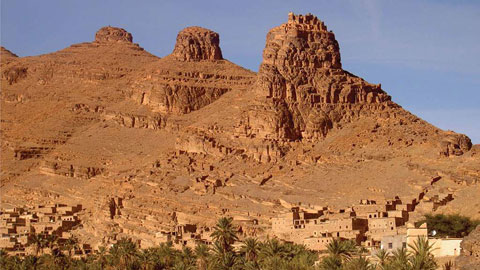
Géo éco tourisme inclusif
Le coins de l’étudiant


Blog Géoparc Jbel Bani
Dictionnaire scientifique
Plus de 123.000 mots scientifiques
Les publications
Géo parc Jbel Bani

Circuits & excursions touristiques
cartothéques
Photothéques
Publications & éditions